
 Yahoo Movies
 Heavy rainfall prompts flood warnings and travel disruptions in UK
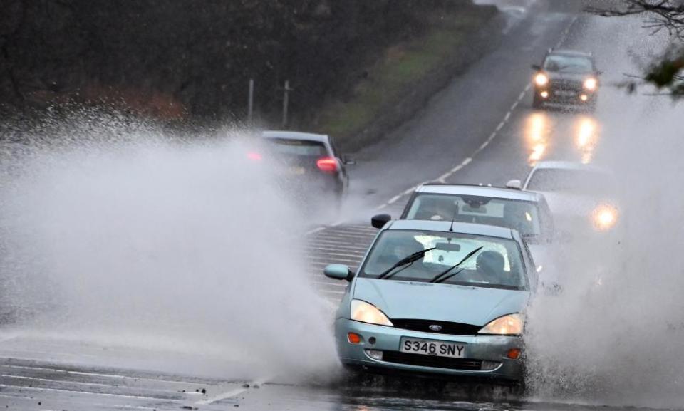
Parts of Scotland and southern England experienced transport disruptions and multiple flood warnings on Saturday morning following heavy rainfall.
While Friday brought “thundersnow” to some parts of Scotland, and other parts of the UK woke up to wintry scenes, Saturday’s forecast featured more rain.
National rail reported flooding on some of its Scottish routes, including trains through Livingston North, west of Edinburgh. The Scottish capital also reduced its tram services to one route following the heavy rain.
In England, the Environment Agency warned that flooding was expected across 11 locations in the south of England including Cambridgeshire and Scarborough, and informed residents that “immediate action” was required. In Cambridgeshire, Huntingdon Racecourse announced races would be cancelled on Saturday after track and facilities flooded.
However, by the afternoon, just one flood warning remained in Swanage, Dorset, which had 31mm of rainfall in six hours. There were also 46 flood alerts in force, meaning that flooding was “possible” and residents should “be prepared”.
A yellow weather warning, which indicates a risk of flooding to some homes and businesses and possible transport disruptions, was also in place over Marlborough, Salisbury, Southampton and parts of Winchester following heavy rain on Saturday morning. According to Steven Keates, an operational meteorologist at the Met Office, those areas saw rainfall of between 25 and 30mm.
Until Saturday afternoon, a yellow weather warning was also in place in areas of north-east Scotland, including Inverness and Aberdeen, which had been expected to get 40mm of rainfall.
Keates said Drumnadrochit on the shores of Loch Ness had been “the wettest place in the last 24 hours”, recording 48.6mm of rain.
The cold weather is set to continue over the weekend, with the Met Office forecasting that temperatures will remain in single digits and icy conditions are likely to persist until Tuesday.
“In summary, it’s a bit messy this weekend. It’s staying cold, gradually becoming a bit drier and we’ll switch our attention to some overnight frost, and I think tomorrow morning will see some dense freezing fog patches in places,” said Keates.
Thursday night was the coldest night of the winter so far, with the mercury dropping to -9.6C (14.7F) at Altnaharra, Sutherland, in the Highlands. Many residents of Edinburgh contacted emergency services after being woken in the early hours of Friday morning by loud explosions, which were caused by thundersnow. The phenomenon is caused when thunderstorms form in wintry conditions, and produce heavy snowfall.
Keates said Friday’s snowfall was likely to have been “the most widespread snow of the season so far”.
However, temperatures are yet to top those seen on 13 February, which was the coldest night of 2020 so far. Temperatures of -10.2C (13.6F) were recorded at Braemar in Aberdeenshire.
