Batman V. Superman: Gotham City & Metropolis Maps Revealed

After Turkish Airlines did their pair of TV spots for Batman v Superman: Dawn of Justice featuring travel videos promoting Metropolis and Gotham City, the company then launched a website supporting the film release. The site features travel information about both fictional DC Comics cities with all of your standard things like highlighted attractions, restaurants, and more.
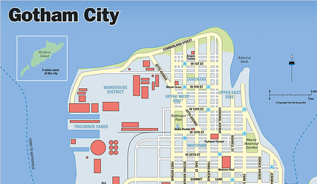
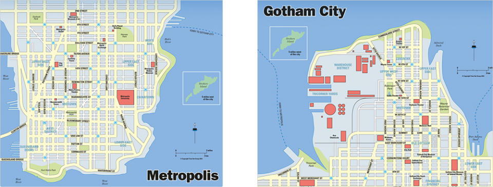
There were also partial maps revealed of the layouts of the cities in the movie universe, with the ferry that connects them on display.

The river between the two cities is apparently quite expansive, with ten miles between them - we know that because Stryker's Island appears on both maps, 5 miles west of Gotham and 5 miles east of Metropolis. Other notable landmarks on the maps include the Wayne Botanical Garden and Wayne Tower in Gotham, and Heroes Park outside of the Daily Planet Building in Metropolis.
The text also notes places like Amusement Mile and the Clocktower in Gotham City, two places that comic book fans will note as very important. The large venues in Metropolis are Shuster Arena and Siegel Music Hall, nodding to Superman's creators.
Check out the website and pore over it for more hints and details. It looks like things will be updated closer to the film's release on March 25, 2016, with Time Out magazine doing guides of the cities as well. They're also offering BvS branded miles credit cards, and a chance to win a trip to the movie's premiere.

 Yahoo Movies

